
Transformative Gaussian Splats
At GeoWeek 2025, SRS attended the session “Unlocking 3D Innovation – Understanding NeRFs, Radiance Fields, and Splats,” where speaker Ben Stocker of Skender highlighted just how far Gaussian Splatting (GS) has come in a single year. At GeoWeek 2024, Ben faced questions like, “What can we do with this?” or, “Can we measure it?” In 2025, the technology has progressed so rapidly that its potential feels boundless. In the future GS will play a key role in data fusion with lidar and imagery, solving challenges like the infamous “melted ice-cream trees” produced by Structure-from-Motion (SfM). The session also included other GS pioneers like Michael Rubloff of Radiance Fields, Ted Parisot of Helios Visions, and Sean Young from NVIDIA.
The industry is beginning to adopt GS in meaningful ways. Pix4D announced support for GS at GeoWeek, marking a significant step toward integrating the technology into mainstream workflows. Companies like XGRIDS are also incorporating GS into their toolsets, blending it with traditional reality capture methods to provide more complete solutions. These early adopters are laying the groundwork for GS to become a standard part of the geospatial professional's toolkit, supplementing existing technologies.
GS is revolutionizing reality capture, with its growth taking off like a rocket. The photorealistic 3D technology is truly disruptive, enabling anyone to produce high-fidelity 3D content using just a smartphone—whether from still imagery or video. Much like lidar and photogrammetry complement each other, GS enhances both by excelling where those methods fall short. Reflective surfaces, windows, sky, thin wires (even hair), and water—typical challenges for lidar and photogrammetry—are no problem for GS. Even consumer-grade equipment, like rolling shutter cameras, fisheye lenses, and basic smartphones, works seamlessly with this approach. The data is generally smaller in file size comparatively to point clouds & meshes, and renders highly efficiently. However, there is a risk when organizations create large volumes of data without an effective management plan. That’s where a consultant’s expertise can help—aligning data acquisition with strategic goals.
As a geospatial company focused on achieving high accuracy data verified using the ASPRS Standards for Digital Geospatial Data, we recognize the limitations of GS in terms of geometric accuracy. While it can be georeferenced, it does not match the accuracy of static terrestrial laser scanning or photogrammetric methods of reality capture. However, for facilities management and owner-operators working at larger scales with many facilities, millimeter-level accuracy is often unnecessary and cost-prohibitive. GS provides a cost-effective, scalable solution for virtual site visits and collaboration, offering similar 3D data capture capabilities at a fraction of the cost—and virtually any camera can produce it. Applications include progress monitoring for construction, facility & infrastructure inspections, historical preservation... and digital twins to name a few.

A down sampled Gaussian Splat fly-through of the Denver Legislative Services Building
Beware - The Digital Twin
The term digital twin was everywhere at GeoWeek, but it’s still a bit murky in terms of what it truly means. A digital twin could be a Gaussian Splat (GS) model of a fruit tree, a point cloud representation of an open pit mine, a 3D textured mesh of a building, or something else entirely (depending on who is saying it and their interpretation of the phrase). The key point to remember is that digitization itself isn't the end goal. Digital representations of the built and natural environment are not solutions; they should support decision-making and enable better outcomes.
As a geospatial consultant, SRS has seen firsthand how starting small with digitization—whether it's capturing as-built conditions, monitoring construction progress, or modeling infrastructure—helps unlock operational value faster. It’s about using digital data to proactively prioritize services and address building management needs before issues become costly problems.
However, the question remains: who is going to pay for all this digitization? In a typical owner group, no one wants to foot the bill. But by identifying the biggest pain points within the organization by combining digitization with spatial Artificial Intelligence (AI)—to predict construction delays, for clash detection, for safety monitoring, or to reduce maintenance costs and down time—you can uncover the value that digitization brings to many parts of the business.
This is where a geospatial consultant comes in, to support digitization for real world solutions. In episode 26 of the ASPRS Mentors Podcast, Marko Radanovic discusses how important it is to define the scope of a project early and align it with comprehensive solutions, rather than getting caught up in buzzwords. As a company that works with geospatial data daily, SRS can help you avoid the pitfalls of vague digital twin promises and instead build a solid foundation that brings real, measurable benefits to your organization. Don’t risk investing in the wrong kind of “digital twin”—get the right solution from the start. Trust us, when requesting a digital twin of your facility, the last thing you want is to go through the entire process and end up with something like a 3D fruit tree.

Ubiquitous Hardware
Walking into the exhibition hall at GeoWeek was nothing short of impressive, with the sheer scale and variety of hardware on display. However, it quickly became clear how overwhelming it can be to navigate the seemingly endless array of options. With so many different types of systems available the decision-making process can become paralyzing if you don't know exactly what you're looking for.
When it comes to choosing the right geospatial hardware, there’s no one-size-fits-all solution. Whether it’s an Unmanned Aerial System (UAS), SLAM-based scanner, tripod-based terrestrial laser scanner, Mobile Mapping System (MMS), or a 360 camera, each tool has its specific use case. Yet many teams make the mistake of purchasing hardware that doesn’t align with their needs, which can result in wasted money, lost time, and damage to their reputation.
To avoid these pitfalls, engaging with an unbiased geospatial consultant who can provide in-depth research into current hardware & software offerings—and conduct a business integration check—can save both money and frustration. A consultant will assess how a hardware/software system fits into your existing infrastructure and provide a comprehensive recommendation. This not only helps you avoid costly mistakes but ensures the system delivers the results your clients expect.
For example, take a popular MMS manufacturer, which offers 10 different drone-based MMS models and recently released 2 more at GeoWeek. This is common in the industry, with many manufacturers frequently pushing out multiple variations. But the small differences between these systems—such as range, accuracy, or software compatibility—can significantly impact your decision. You need to rely on experts who can guide you through these nuances and ensure you pick the right tool for the job, rather than being swayed by spec sheets or promotional videos.
It’s crucial to remember that selecting hardware isn’t just about looking at numbers on a page. The entire data processing workflow must be considered, especially the end products you need, their required accuracies, and the solutions they provide. An experienced consultant can help you evaluate these factors and choose a system that fits your specific goals and infrastructure.
Canada’s Advantage for U.S. Businesses
With the current exchange rate, U.S. businesses can access high-quality Canadian geospatial services at a lower cost. For example, something as simple as a meal in the U.S. might cost a Canadian significantly more due to the exchange rate disparity (think $94 CAD fish & chips). Similarly, U.S. companies can benefit from this gap by leveraging Canadian expertise in geospatial consulting and data processing, all while paying less than they would for comparable services domestically.
Canadian firms, like SRS, bring a wealth of experience and a proven track record in geospatial solutions, and with the exchange rate in their favor, U.S. companies can maximize value without compromising on quality. Now is an ideal time to engage with Canadian professionals, tapping into top-tier talent and cutting-edge technology while saving on costs.
Random Musings
The Denver airport definitely has a haunted feel to it, which adds a mysterious twist to any trip. Then there’s Meow Wolf—it's something that simply can’t be explained until you experience it for yourself. The size of the convention center was nothing short of impressive, and yet, it was the people that stood out most. The ASPRS and RCN communities truly shine with their welcoming nature, offering a space for friendly, passionate people with shared interests to connect and grow.
And yes, as is often the case with these events, trying to capture everything from three full days into a blog is no easy task. There’s so much to take in, and it’s impossible to do it all justice in just a few words. But in the end, it’s these little details and connections that make the experience unforgettable.
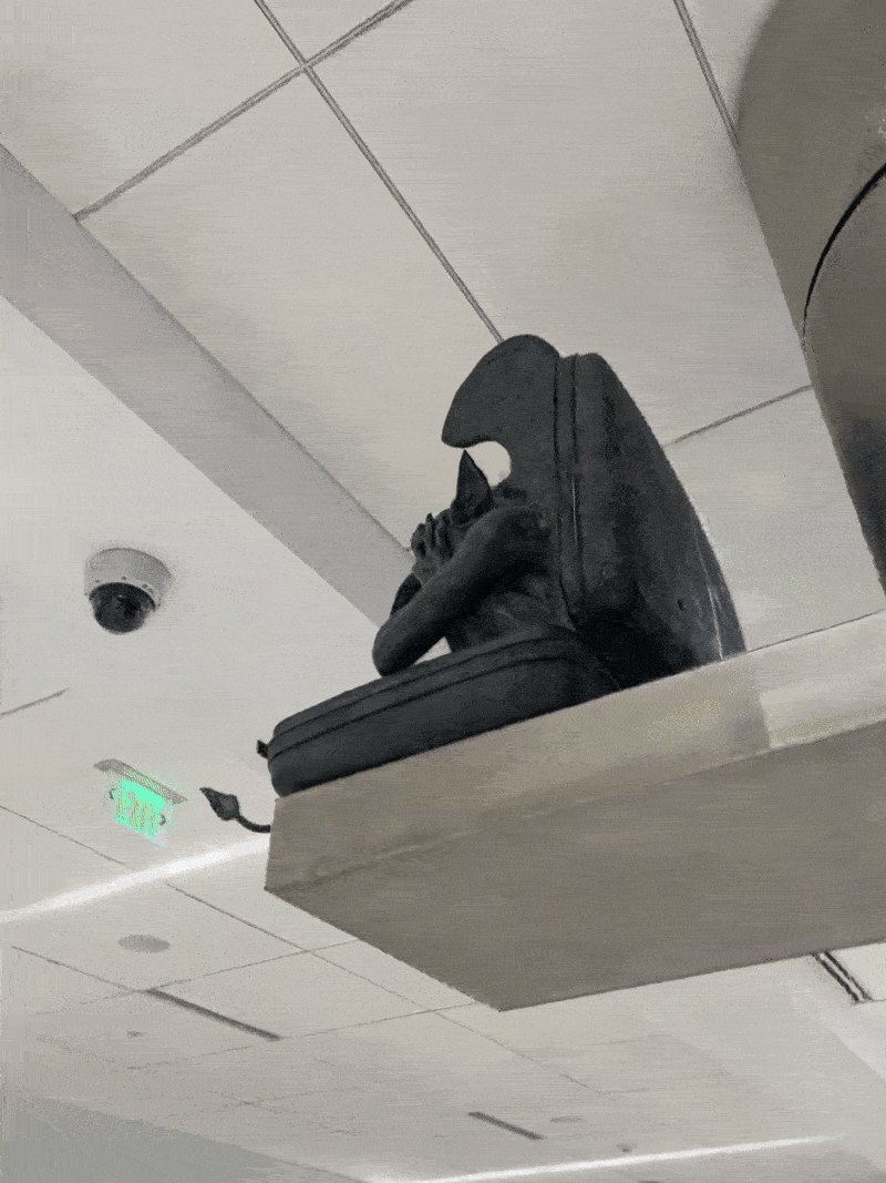
GS rendering of one of DEN’s iconic residents